Satellite images of the craters reveal the strength of asteroids and meteorites colliding with Earth
It looks like something you’ll find in a galaxy far away.
But these stunning satellite images show the devastating impact that asteroids and meteors have carved onto Earth’s surface, resulting in a number of strangely beautiful sites.
The eye-catching images of the world’s first atlas show the various craters that can be found around the world.
Stunning satellite images show the devastating impact that asteroids and meteors have carved onto the surface of the Earth like Shoemaker in Western Australia (pictured)
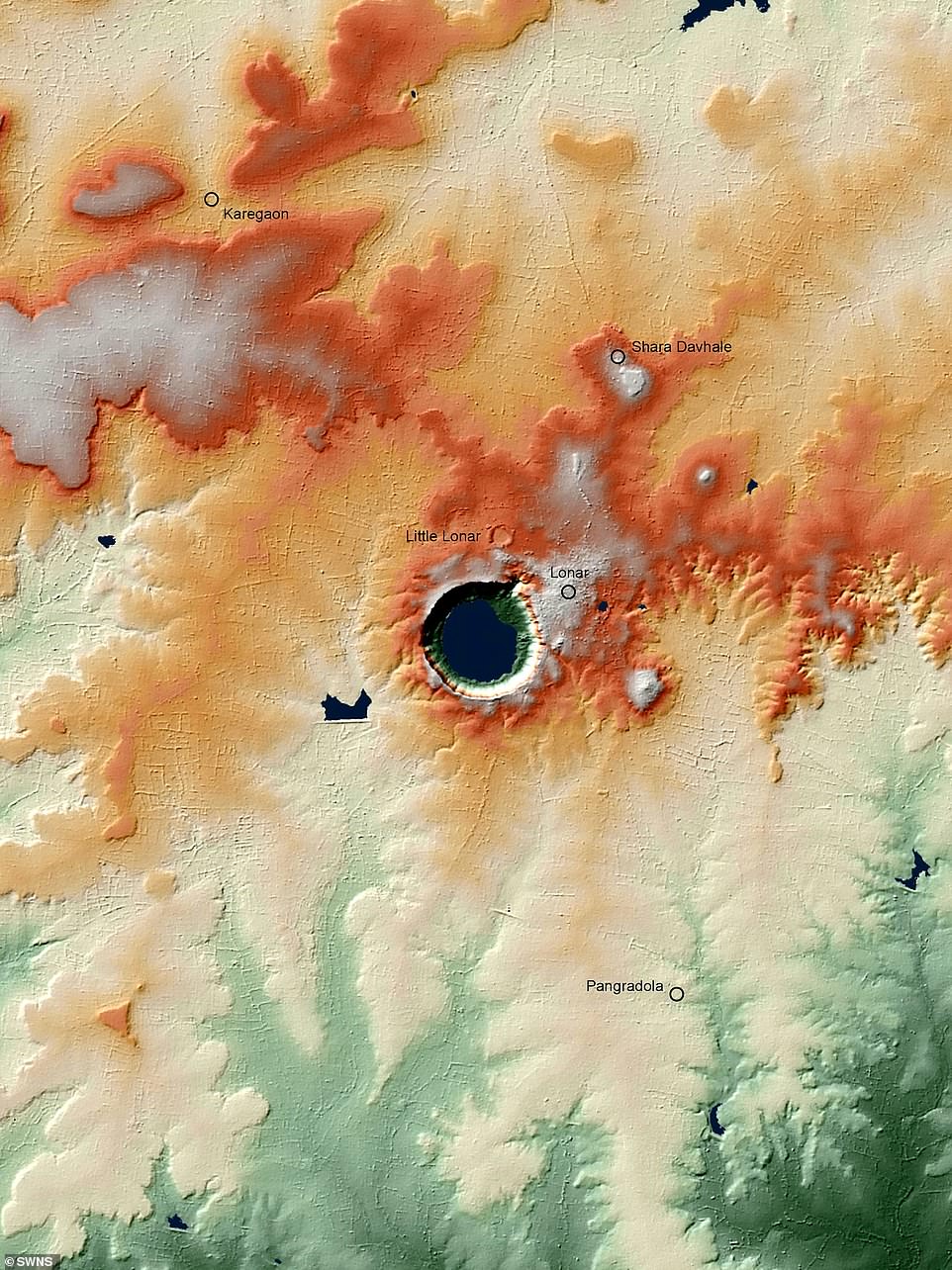
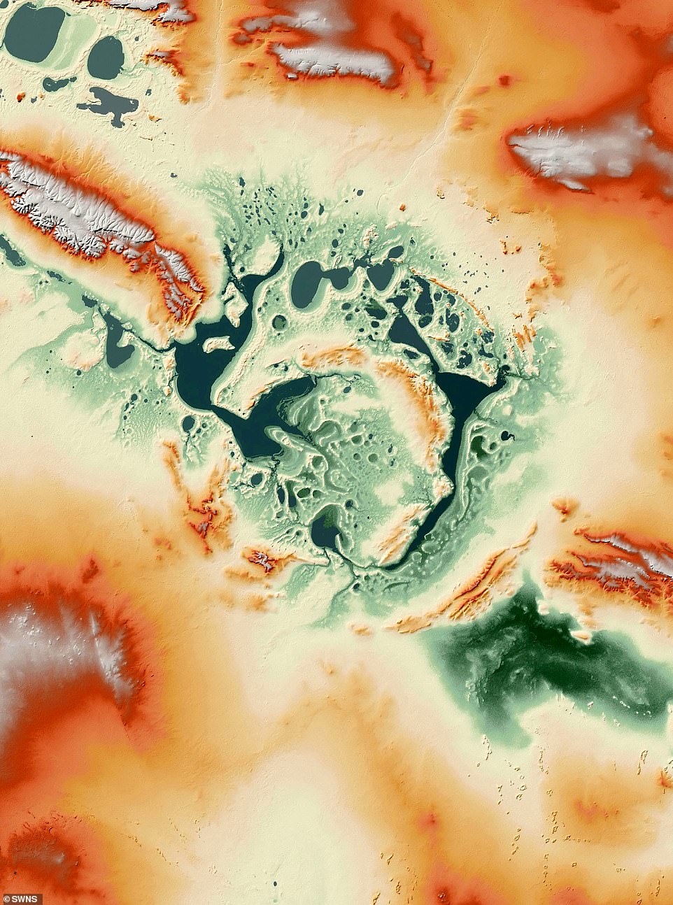
Eye-catching images show the world’s first atlas of craters that can be found around the world such as Lonar in India (pictured)
The 600-page book displays more than 200 locations made up of asteroids and comets crashing into the planet, in high-resolution topographic maps and satellite imagery.
Includes detailed geological descriptions and pictures of stunning rocky landscapes.
The volume, entitled Ground Impact Structures, includes “key details” about each collision crater, including those that have now disappeared from view.
Most craters last only a few thousand years before they are filled or eroded, and they can only be identified by the unique changes in Earth’s minerals from the shock wave generated by the collision.
Co-author Professor Thomas Kinkmann from the University of Freiburg in Germany said: “ Crater formation by asteroid and comet collisions has always been a fundamental process in the solar system.
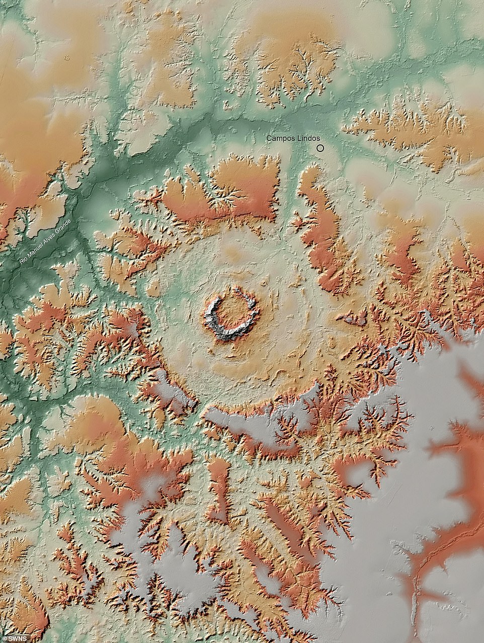
The 600-page volume shows more than 200 sites like Serra da Cangalha in Brazil (pictured) that consist of asteroids and comets crashing into the planet.
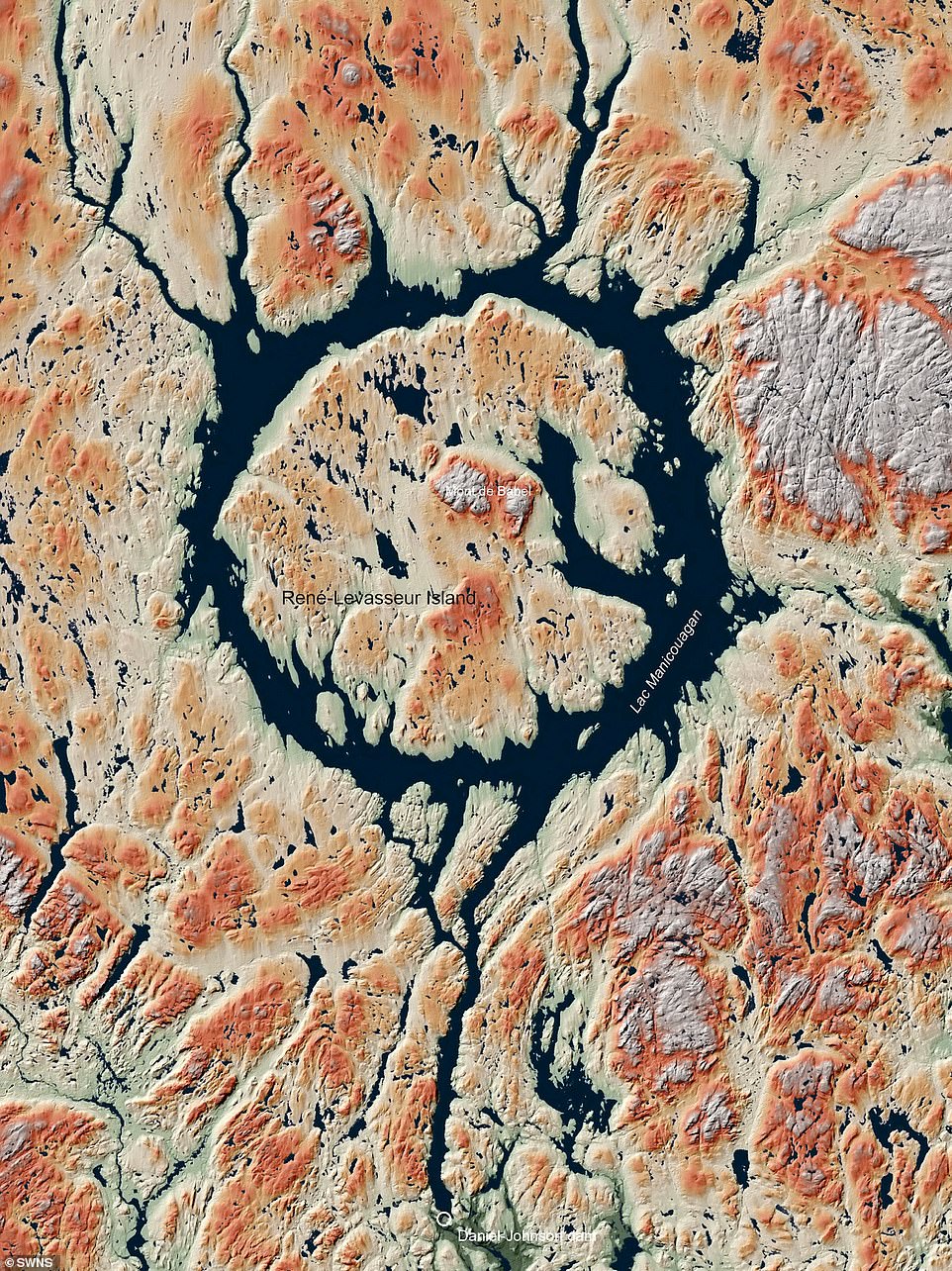
Researchers used a low-orbit radar satellite called TanDEM-X between 2010 and 2016 to measure every known crater on Earth’s surface with an altitude accuracy of a meter. Pictured: Manicouagan crater in Quebec, Canada
“As planets evolved alongside their moons, these effects played an important role in increasing planetary mass, shaping the surfaces of planetary bodies, and then also affecting their subsequent evolution.”
The impacts of the larger meteor also ultimately affected the evolution of life on Earth.
Researchers used a low-orbit radar satellite called TanDEM-X between 2010 and 2016 to measure every known crater on Earth’s surface with an altitude accuracy of a meter.
These measurements helped them build a digital terrain model for every known crater including Manicouagan Crater in Canada, Cerro de Garo in Brazil, Shoemaker in Western Australia, and Gweny Vada in Chad, Africa.
Professor Kinkman said: “ Over the past 50 years, lunar and planetary spaceflight has provided us with detailed maps of the ancient surfaces covered in the impact crater of our neighbors in the Solar System.
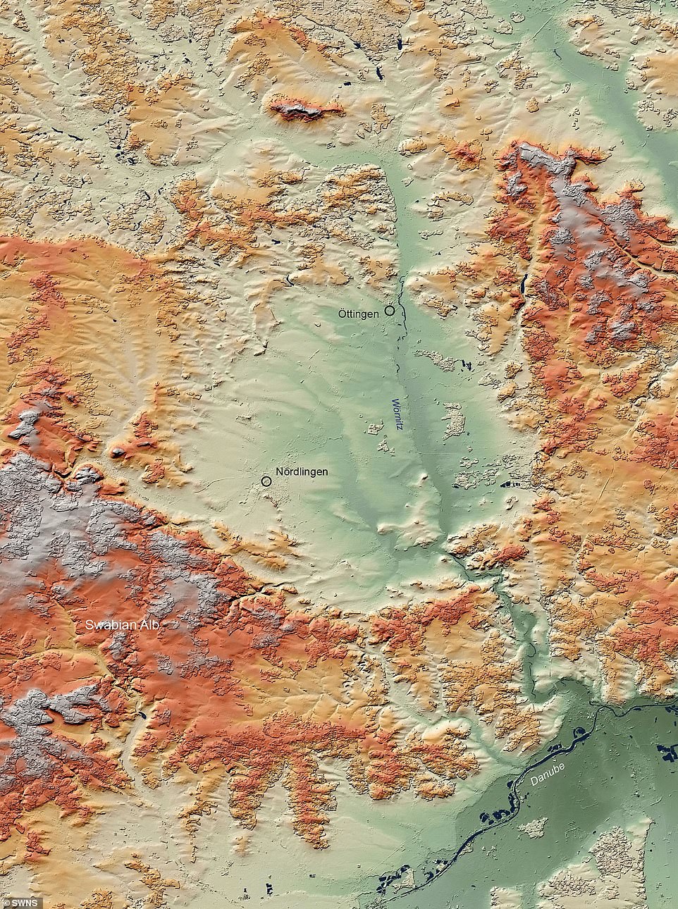
Most craters, such as Ries in Germany (pictured), only last a few thousand years before they are filled or eroded, and can then be identified only by the unique changes in Earth’s minerals from the shock wave of the collision.
“For Earth, the Global Shock Crater Record represents a fraction of the bombardment that our planet has endured.”
The books also introduce readers to basic principles of impact drilling, radar remote sensing, and provide details of the TanDEM-X mission and the researchers’ fieldwork.
Famous craters such as the Vredefort Crater and the Chicxulub Crater in the Yucatan Peninsula, Mexico, also featured in the Atlas, which put an end to dinosaurs.
The largest and oldest crater in the world, Vredefort, is thought to have been at a distance of 185 miles and 25 miles in width, and that it appeared when a meteor or asteroid struck what is now South Africa about 2.02 billion years ago.
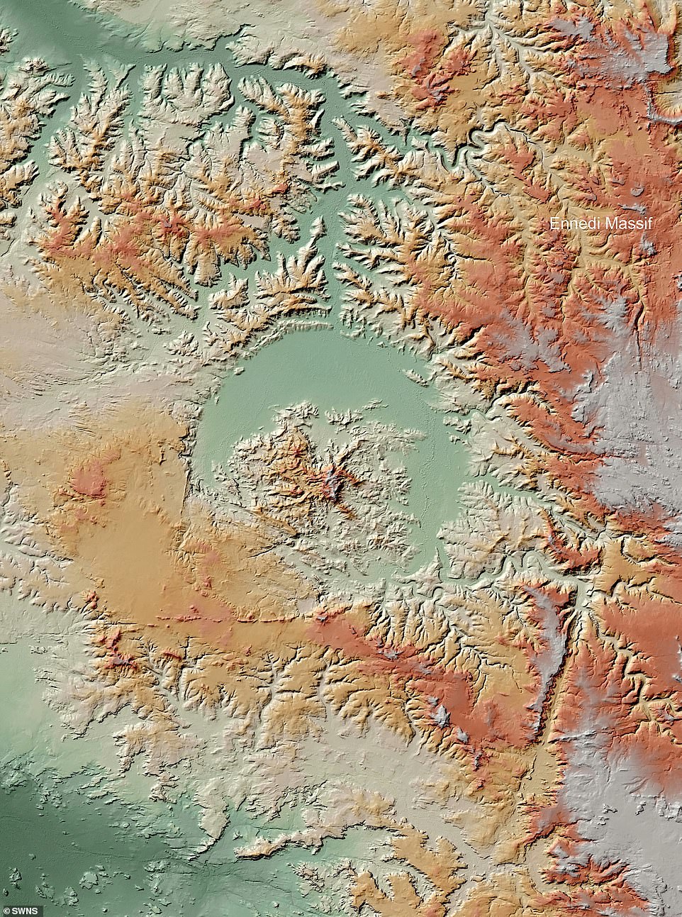
The books also introduce readers to basic principles of impact drilling, radar remote sensing, and provide details of the TanDEM-X mission and the researchers’ fieldwork. Pictured: Guindy Vada crater in Chad
It is really difficult to gauge the size of these collisions as the craters have shrunk and in many cases disappeared.
Professor Knkman said: “ The surface of our planet is always changing and after a few thousand years the craters can disappear.
In some, a lake is formed or buried, and in others it is completely eroded.
But the shock wave creates unique changes in Earth’s minerals, so even if you don’t see the crater, the shock wave remains.
“What we summarize in this atlas are all proven influence structures, even the ones you don’t see.”
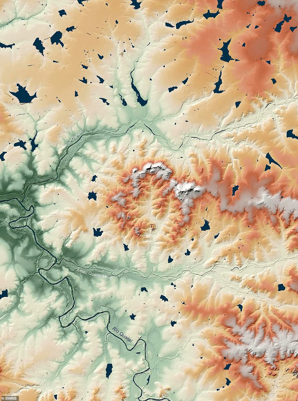
The measurements helped them build a digital terrain model for every known crater, including the Manicuagan Crater in Canada and Cerro de Garo in Brazil (pictured).
The UK’s largest underwater crater, about 25 miles off the northwest coast of Scotland, and thus does not appear in the Atlas.
The underwater crater, first discovered in 2008, when a rock weighing 3 billion tons collided with the Mitch Basin, between Lewis and Harris Islands at the Outer Hebrides at 40,000 mph.
Asked about his favorite crater, Professor Kinkman said: “ I have a special relationship to those craters where I have conducted fieldwork, sometimes under adventurous conditions.
Australian pits often need helicopter access, after which you are alone there in outlying areas for two weeks to map and investigate crater structures.
‘This is really cool.’
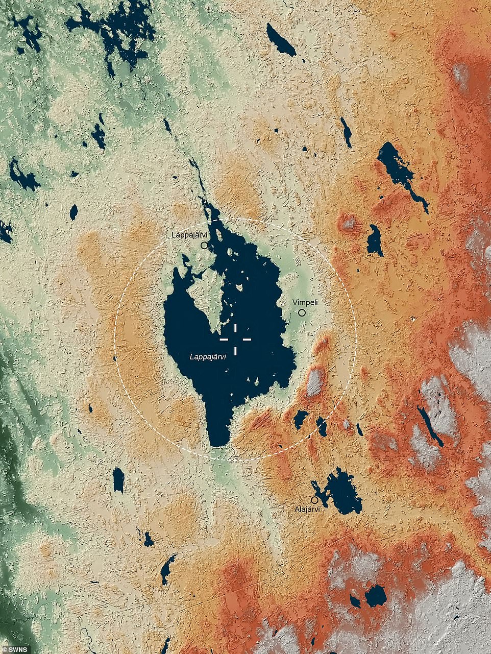
Famous craters such as the Vredefort Crater and the Chicxulub Crater in the Yucatan Peninsula, Mexico, also featured in the Atlas, which put an end to dinosaurs. Pictured: Lappajarvi Crater in Finland
He added, “ It was really good to investigate the formally astonishing crater Upheaval Dome in Utah in Canyonlands National Park on the Colorado Plateau.
This crater is severely eroded and gives full 3D visions of what is happening to the rock beneath the crater.
Incidentally, this crater was originally thought to be a salt dome so we were able to discover the traumatic minerals and prove the source of their impact.
The books, which come in a bag, are available for purchase on the Verlag Pfeil publisher’s website.

Rachel Montgomery is a contributor at Prudent Press Agency, covering a wide range of topics including news, politics, business, technology, sports, entertainment, and lifestyle. She focuses on delivering clear, accurate, and reader-focused reporting that helps audiences stay informed about current events and important developments. Her work emphasizes useful information, balanced coverage, and stories that matter to everyday readers, making complex topics accessible and relevant.