Unique comparison: Watch how the Earth has changed in 40 years
The US tech company Google has added a new functionality to its Google Earth map app, which uses satellite images captured over 40 years to show the impacts of climate change on glaciers, beaches, forests and other places on Earth. The tool is part of a major update of a well-known program, and the company has worked with NASA and its European counterpart ESA, according to the AP.
The goal of the new tool is to bring climate change closer to the general public in a tangible way, which many people often view somewhat abstractly. Cornell University.
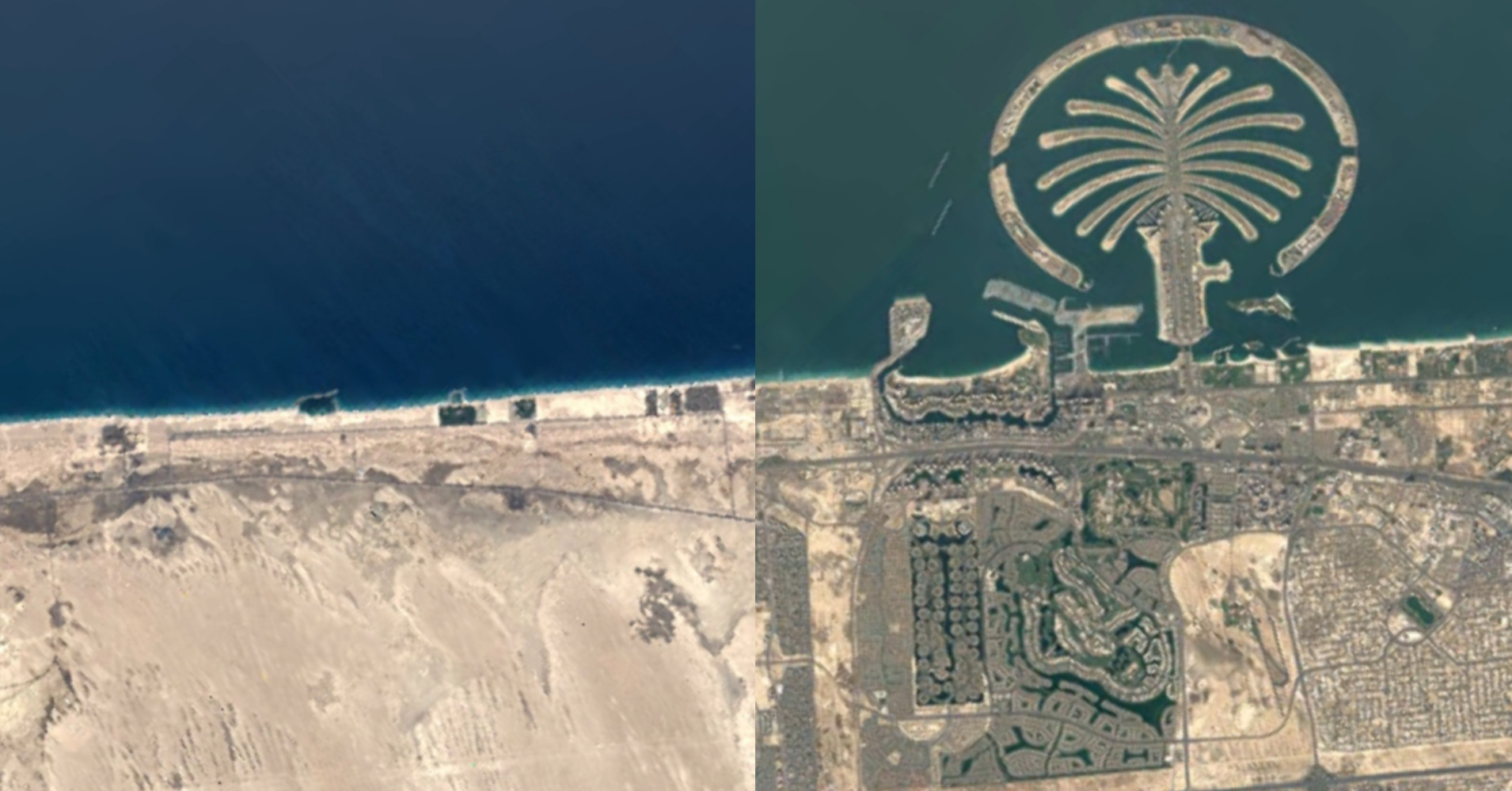
Comparison of urbanization in Dubai (Palm Islands, United Arab Emirates) in 1985 (left) and 2020 (right). Photo: © Google Earth
Time-lapse satellite images are published regularly, but in the past they were mainly related to melting glaciers and were not widely available. Google Earth is free for almost all people who have over three billion mobile phones in the world.
Google pledges that users will be able to view satellite images from virtually anywhere in the world of their choice. In addition to that, the app will also provide a selection of 800 different locations on Earth, which users will be able to view as images as well as 3D models.
Draining the Aral Sea. The image on the left is from 1984, the right is from 2020. Image: © Google Earth
The company launched the new functionality with the help of 24 million satellite images captured annually from 1984 to 2020. The materials were provided by NASA, the US Geological Survey and the European Union. The company worked with Carnegie Mellon University in Pittsburgh to develop software to track time-lapse developments.

Andrew Prescott is a contributor to Prudent Press Agency, covering a wide range of topics including news, politics, business, technology, sports, entertainment, and lifestyle. He focuses on delivering clear, balanced reporting and practical information that helps readers stay informed about current events and emerging developments. His work highlights stories that matter to everyday audiences, with an emphasis on accuracy, relevance, and accessible journalism.